


You are using an out of date browser. It may not display this or other websites correctly.
You should upgrade or use an alternative browser.
You should upgrade or use an alternative browser.
Post your photography!!
- Thread starter uofmtiger
- Start date


Lou G
Super Member
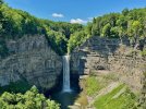
Great day for hiking and decided on Taughannock Falls State Park. The park has several trails and we decided to hike the North and South RIM loop trail, which is about 3.1 miles. This view of the waterfall is from the North Rim Trail. This 215-foot waterfall is located on Taughannock Creek which feeds Cayuga Lake in the Finger Lakes region of NY.

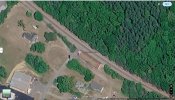
Tried to find this on Google Earth - I found the area, but can't spot it.
mhedges
Super Member
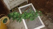
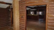
OK back to the abandoned house from before

Looking Downstairs (MD abandoned house) by Mark Hedges, on Flickr
Looking Downstairs (MD abandoned house) by Mark Hedges, on Flickr
mhedges
Super Member
Tried to find this on Google Earth - I found the area, but can't spot it.
Google Maps
Find local businesses, view maps and get driving directions in Google Maps.
 maps.app.goo.gl
Thanks!
Google Maps
Find local businesses, view maps and get driving directions in Google Maps.

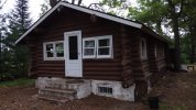
The house that is no more.


mhedges
Super Member
Very nice. The state parks are the thing I miss most from when I lived in that area.Great day for hiking and decided on Taughannock Falls State Park. The park has several trails and we decided to hike the North and South RIM loop trail, which is about 3.1 miles. This view of the waterfall is from the North Rim Trail. This 215-foot waterfall is located on Taughannock Creek which feeds Cayuga Lake in the Finger Lakes region of NY.
View attachment 3807654

From Google Maps, this might help:Tried to find this on Google Earth - I found the area, but can't spot it.
Lou G
Super Member
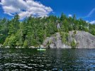
Bluff Island on Lower Saranac Lake in the Adirondacks. The island is accessible via a 2 mile paddle from the Second Pond Boat Launch. The island is for day use only and features a picnic area and several swimming areas. The 66 ft vertical cliff is popular for cliff jumpers. We use it as a stopping point for lunch when paddling to our campsite on one of the islands.
mhedges
Super Member


mhedges
Super Member

"Care for a nap?"
Um, no, don't think so.


Old Ears too
Super Member
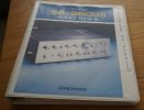
I guess photo down load might be working now.
Lou G
Super Member
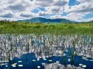
After leaving Bluff Island and paddling across Lower Saranac Lake, about 3 miles, we enter the channel (Saranac River flow) that connects Lower Saranac Lake to Middle Saranac Lake. After about a 1 mile paddle on the Saranac River, we will have to pass through a set of locks before we can proceed on to our campsite on Middle Saranac Lake. The channel provides majestic views of Ampersand Mt. as shown in the photo below.

Title could be: Ready for Occupancy or Get Out...

Lou G
Super Member
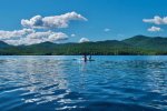
After going through the lock on the Saranac River, followed by a 1 mile paddle, we finally enter Middle Saranac Lake. Our campsite is on Umbrella Point, about 1.5 miles farther on the north shore of the lake. Along this paddle we often observe loons, osprey, eagles, woodpeckers, black ducks, blue herons, hawks, and other birds. In the channel, we often observe beavers, otters and turtles.
Last edited:
Lou G
Super Member
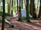
A few pictures of our campsite on Umbrella Point. We usually try to get a campsite on one of the islands but reservations have to be made in December to guarantee a specific site. This was a last minute decision and we were lucky to find a site. We were familiar with this site because we have camped here before. Although on the shoreline, there are no other campsites within a quarter of a mile. All of these campsites are well laid out with plenty of spots for multiple tents, typically 2 picnic tables, a fire pit with plenty of firewood, a grill, and an outhouse.


Similar threads

- Replies
- 4
- Views
- 984


- Replies
- 10
- Views
- 5K


